Kyrgyzstan · Trekking

5-Day Alay Valley Trek from Sary-Mogol with Jiptik and Sary-Mogol Pass

5 Days Round trip from Pereval Sary-Mogol Moderate pace

The journey

Trip highlights
  • 01 Cross Sary-Mogol Pass and admire the stunning scenery of the Besh-Kol lakes
  • 02 Walk through the beautiful Kichik Alay range, mountain gorges, and traditional villages
  • 03 Discover Kojo-Kelen village, known for its red rock formations, waterfall, and Blue Cave Pool
  • 04 Stay with local Kyrgyz families in shared yurts and homestays along the trekking route
  • 05 Enjoy panoramic views of Lenin Peak and the Pamir-Alay valley from Jiptik Pass

Trek through the breathtaking Trans-Alay mountains on a 5-day loop from Sary-Mogol, crossing high passes, alpine valleys, and traditional villages in the Alay Valley. Admire the stunning Besh-Kol lakes from Sary-Mogol Pass, walk through the beautiful Kichik Alay range, and experience warm Kyrgyz hospitality in yurts and homestays along the route. Discover the red rock formations of Kojo-Kelen, its enchanting waterfall, and the Blue Cave Pool before continuing to Jiptik yurt camp. The journey ends with a rewarding crossing of Jiptik Pass, where clear skies reveal panoramic views of Lenin Peak and the Pamir-Alay valley.

The journey ends with a rewarding crossing of Jiptik Pass, where clear skies reveal panoramic views of Lenin Peak and the Pamir-Alay valley.

From the itinerary

At a glance

What this trip includes

Duration 5 Days
Tour type Private
Activity level Moderate
Accommodation Included · Budget
Transport Included
Wheelchair access No
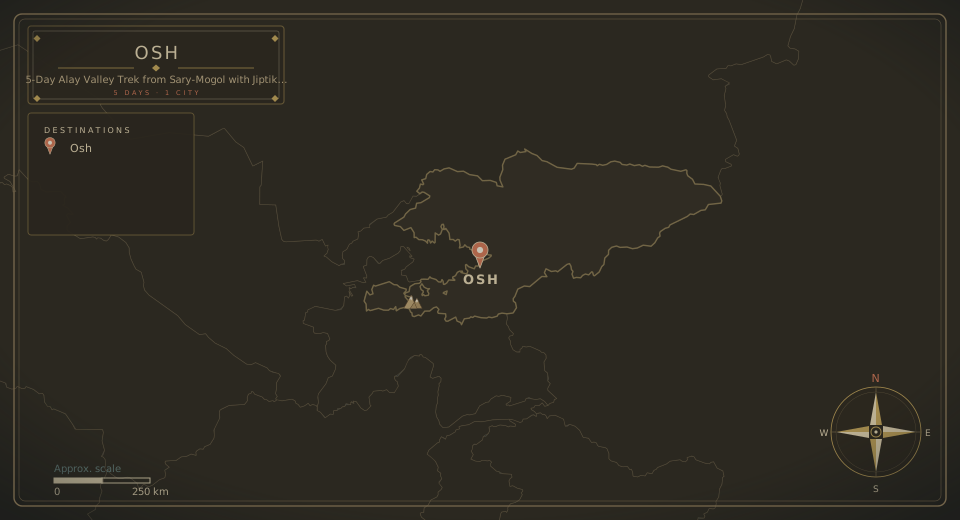
City Osh
Languages English, Russian

Day by day

The itinerary

1
Day 01

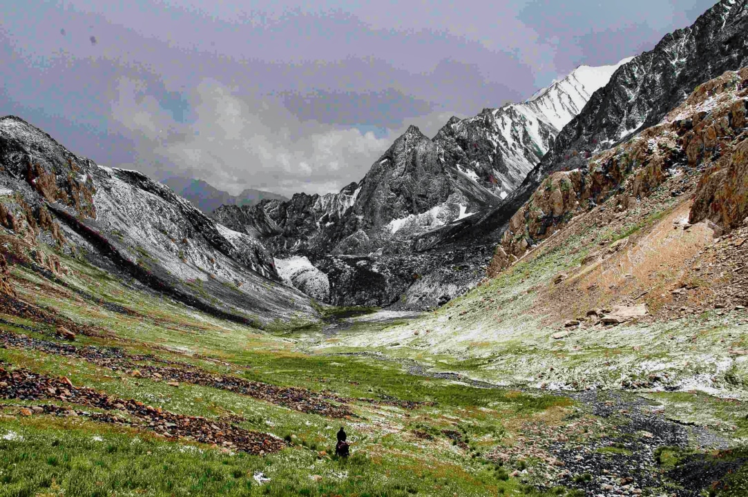
Sary-Mogol Pass Trek to Besh-Kol and Yurt Camp

  • Today, continue trekking in the northern range of the Alay Valley (Trans-Alay).
  • Travel by car from Sary-Mogol to the trailhead for about 1 hour, then begin the trek. This is a fairly tough day, as the route climbs to Sary-Mogol Pass (4,270 meters) and Besh-Kol Lake.
  • The daily route involves 6-8 hours of walking uphill on a rocky path. At the top of the pass, enjoy the stunning scenery of the Besh-Kol lakes.
  • Then continue down the other side until reaching the yurt camp.

Approximate trekking distance: 14 km (8.70 miles)

Hiking time: 6 hours, excluding driving

Ascent/Descent: 910/790 meters

Highest and lowest points: 4270/3380 meters

Accommodation altitude: 3382.00 meters | 11095.80 feet

Despite the lack of roads, local families set up yurts for overnight stays with shared living space and a flush toilet, making travelers more comfortable so they do not have to carry too many things.
2
Day 02

Gorge Walk to Koshmoinok via Kyzyl-Chara

  • Head east, following the river and descending slightly toward the end of the beautiful mountain gorge.
  • Enjoy grand views of the Kichik Alay, or Trans-Alay, mountain range. First, cross a small village below Sary-Mogol. Then the route turns right onto a dirt road. After 2-3 hours, reach the small village of Kyzyl-Chara and stop for lunch in a homestay or at one of the cafes along the way, before continuing to the yurt camp in Koshmoinok.

Approximate trekking distance: 18 km (11.18 miles)

Hiking time: 7 hours, excluding lunch and break time

Ascent/Descent: 830/1460 meters

Highest and lowest points: 3467/2467 meters

Accommodation altitude: 2822.00 meters | 9258.53 feet

Despite the lack of roads, a local family from Kyzyl-Shoro village installed a solar water-heater shower and a running-water toilet. There are 2 shared yurts and a hut for eating.

3
Day 03

Panoramic Trail to Kojo-Kelen Village

  • Begin the day on a scenic trail with panoramic views of Sary-Bel Pass (3150 m) and untouched nature, with the sound of birds and rushing rivers as your companions. This beautiful route leads to the picturesque village of Kojo-Kelen, renowned for its red rock formations and authentic charm.
  • Evening experience in Kojo-Kelen:
  • Upon arrival, settle into a cozy homestay, where you will be welcomed with warm Kyrgyz hospitality. Before dinner, take a short walk to discover two local gems:
    • Waterfall: a hidden cascade with a refreshing ambiance, perfect for relaxation and photography.
    • Blue Cave Pool: a magical spot where turquoise water glows inside a natural cave, ideal for a quick dip or simply admiring its beauty.
  • End the evening with a stroll around the village, immersing yourself in the peaceful rural lifestyle, before enjoying a hearty dinner featuring local dishes.

Approximate trekking distance: 10 km (6.50 miles)

Hiking time: 6 hours, excluding lunch and break time

Ascent/Descent: 340/960 meters

Highest and lowest points: 3127/2230 meters

Accommodation altitude: 2230.00 meters | 7316.27 feet

4
Day 04

Ak-Buura River Trail to Jiptik Yurt Camp

  • Begin your day by following the tranquil path alongside the Ak-Buura River.
  • This trail winds through stunning gorges, lush valleys, and the dramatic landscapes of southern Kyrgyzstan.
  • Along the way, marvel at the contrast between the greenery and the rugged cliffs towering above.
  • As you ascend gently, the air grows crisper and the views become increasingly majestic.
  • This serene walk leads to Bolot's yurt camp, nestled in the foothills of Jiptik Pass.

Approximate trekking distance: 14 km (8.70 miles)

Hiking time: 5 hours, excluding lunch and break time

Ascent/Descent: 1000/10 meters

Highest and lowest points: 3225/2220 meters

Accommodation altitude: 3158.00 meters | 10360.89 feet

5
Day 05

Jiptik Pass Crossing and Return to Sary-Mogol

  • After breakfast, continue trekking up to the top of Jiptik Pass and cross it by noon (4185 m above sea level).
  • If the sky is clear, the pass offers a stunning view of the Pamir-Alay valley with Lenin Peak (7134 m).
  • At the top, stop for lunch and photos.
  • After soaking in the stunning scenery, descend toward Darbaza-Tash, traversing picturesque landscapes.
  • Upon reaching Darbaza-Tash, take a transfer to Sary-Mogol. Accommodation in Sary-Mogol is in a private room.

Approximate trekking distance: 25 km (15.53 miles)

Hiking time: 5 hours walking and 30 minutes driving, excluding lunch and break time

Ascent/Descent: 830/1230 meters

Highest and lowest points: 4150/2970 meters

Accommodation altitude: 2976.00 meters | 9763.78 feet

Sary-Mogol Pass, Besh-Kol lakes, Kojo-Kelen red rock formations, Jiptik Pass

Where this trip takes you

Sary-Mogol Pass, Besh-Kol lakes, Kojo-Kelen red rock formations, Jiptik Pass

The route

Where you'll travel

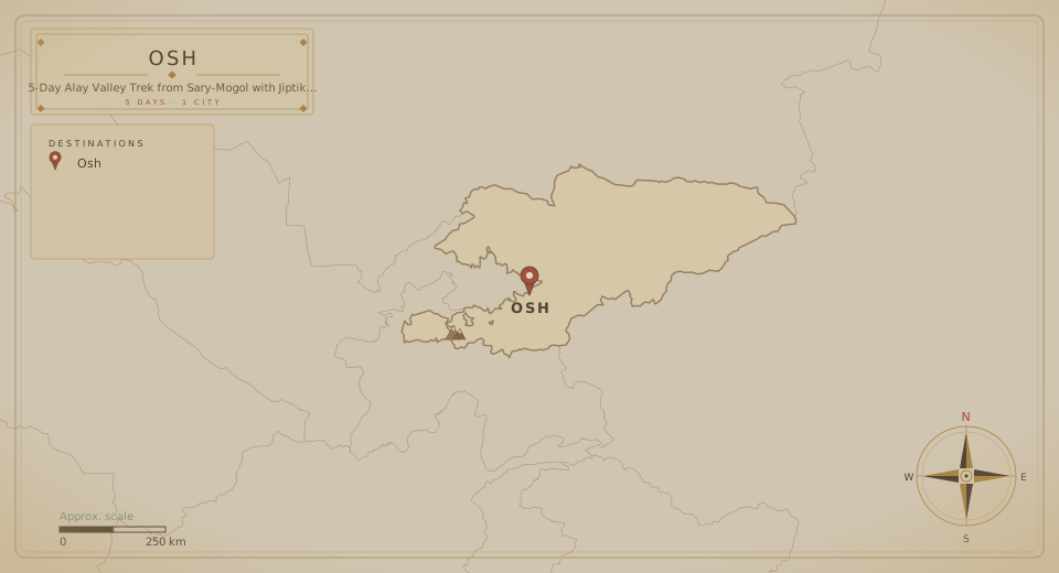
Tour route map
Round trip from Pereval Sary-Mogol 1 city · 5 Days

The fine print

Trip details

What's Included

  • English-speaking, experienced guide
  • 5 nights in shared yurt accommodation during the trek, with 3-4 people in a yurt, except at Tulpar-Kol
  • Guesthouse in Sary-Mogol (2 beds in one room) and homestay in Kojo-Kelen (shared beds)
  • Transport from Osh (airport, hotel, or appointed place) to Sary-Mogol

What's Not Included

  • The return trip will be organized on request following the routes for tourists.
  • There are many options to continue the tour or go somewhere else after this trekking tour.
  • Tourists can use transport from Sary-Mogol to Tajikistan along the Pamir Highway or hire a car to the border with China.
  • Porter for heavy bags.
  • Porters can be organized on request. Some travelers may have only a few things and not need a porter, while others, especially groups, may need one. This service costs extra.
  • Many tourists leave their belongings in Sary-Mogol and go on the hike with a small bag. Because blankets and food will be in the yurts, travelers do not need to carry many things.
  • Additional services: other overnight stays in Osh, or any nights and meals beyond the standard program, are not included in this amount.

What to bring

  • For your safety and comfort, we recommend taking the following items with you. If you suddenly need warm jackets or trousers, you can rent them at our office in Sary-Mogol.
  • Warm and light clothing (jackets, trousers, shoes)
  • Sun protection (cream, glasses, hat, etc.)
  • Please carry money in soms. There is an ATM (Visa card) in Sary-Mogol, just in case.
  • All three networks are available in the villages: O, Megacom, and Beeline.
  • There are markets and night shops in Sary-Mogol, where you can buy snacks and water.

Know before you go

  • For your safety and comfort, we recommend taking the following items with you. If you suddenly need warm jackets or trousers, you can rent them at our office in Sary-Mogol.
  • Warm and light clothing (jackets, trousers, shoes)
  • Sun protection (cream, glasses, hat, etc.)
  • Please carry money in soms. There is an ATM (Visa card) in Sary-Mogol, just in case.
  • All three networks are available in the villages: O, Megacom, and Beeline.
  • There are markets and night shops in Sary-Mogol, where you can buy snacks and water.
  • Not recommended for pregnant women.
  • Not recommended for people with altitude sickness problems.
  • Not recommended for children under 14.
  • Not recommended for people with spine problems.

Name: Loop trek of Sary-Mogol (starting and ending point from Sary-Mogol)
Travel options: Trekking (also available for horseback riders if they have experience)
Duration: 5 days
Season: First of July until the end of September
Group size: Minimum 2, maximum 15 people
Difficulty: Medium to challenging (in the upper lands)
Total walking distance: 70 km (9-12 miles / 15-20 km daily walking distance)
Driving points from/to Sary-Mogol: 16 km (to the beginning point), 12 km (from the ending point)
Reminder for travellers to bring with them: trekking shoes, sunglasses, sunscreen, warm clothing
Ascent/Descent: 4050/4160 meters
Highest and lowest points: 4270/2220 meters

Our trekking tours, developed over many years of practical research and refinement, have become highly popular among European and international nature enthusiasts. These routes are loved by adventurers for their breathtaking landscapes and incredible sensations, making them a must-try in Kyrgyzstan.

In the Alai Valley, the minimum altitude begins at 2,500 meters above sea level and quickly rises higher. Due to the altitude, we recommend this hike for people in moderate physical condition with no altitude-related health problems. The route includes two challenging passes, Sary-Mogol Pass (4,280 m) and Jiptik Pass (4,185 m), with daily treks of 5-6 hours of active walking.

Why Start from Tulpar-Kol?

We design our tours with your comfort and safety in mind:

  • Acclimatization: Around Tulpar-Kol, there are several short, hour-long trekking routes without high passes, allowing participants to naturally acclimatize before starting the main trek.
  • Accessibility: Tulpar-Kol offers reliable connections and internet access, which is vital for safety. If anyone feels unwell or experiences mountain sickness, immediate transport by car is available.
  • Optimal Experience: This starting point provides a safe and enjoyable acclimatization process, enhancing your overall experience.

Logistics

Meeting & route

Meeting point
Osh Airport, Ош, Кыргызстан
Tour start
Pereval Sary-Mogol, Kyrgyzstan
Tour ends at the same location as the start point.
End of the journey

Your 5 days finish where they began, in Pereval Sary-Mogol.

Watch the tourHQ film Watch the film

Create your own adventure

Can't find the perfect tour? Tailor your dream trip.

  • Tell us your destination, dates and group size.
  • Our travel experts and local guides design a tailored itinerary, just for you.
  • Enjoy your trip with peace of mind, knowing everything is taken care of.
Plan my holiday

Say goodbye to travel stress.

Starting from

USD 500 /person
Book This Tour

When

Travellers

Total