Nepal · Trekking

17-Day Annapurna Circuit Trek in Nepal with Tilicho Lake and Thorong La

17 Days Round trip from Kathmandu 44600 Hard pace

The journey

Trip highlights
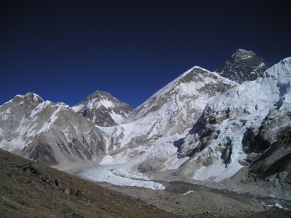
  • 01 Marvel at stunning mountain panoramas along the Annapurna Circuit
  • 02 Explore Tilicho Lake, one of the highest lakes in the world
  • 03 Conquer the exhilarating challenge of crossing Thorong La Pass
  • 04 Immerse yourself in the unique blend of Hindu and Buddhist cultures
  • 05 Witness sunrise views over the Annapurna and Dhaulagiri ranges from Poon Hill

Embark on a 17-day Annapurna Circuit trek with a side trip to Tilicho Lake, where you'll travel through lush valleys, traditional villages, and dramatic Himalayan landscapes. This journey combines cultural encounters with Gurung, Tamang, Thakali, and Tibetan-influenced communities, high-altitude trekking, and unforgettable mountain scenery. Highlights include the turquoise waters of Tilicho Lake, the challenge of crossing Thorong La Pass, the sacred temple complex of Muktinath, and sunrise views from Poon Hill. It is a rewarding adventure through one of Nepal's most iconic trekking regions.

Highlights include the turquoise waters of Tilicho Lake, the challenge of crossing Thorong La Pass, the sacred temple complex of Muktinath, and sunrise views from Poon Hill.

From the itinerary

At a glance

What this trip includes

Duration 17 Days
Tour type Private
Activity level Hard
Accommodation Included · Budget
Transport Included
Wheelchair access Yes
Cities Pokhara, Kathmandu, Annapurna, Besisahar, Ghorepani, Chame, Pisang, Manang, Yak Kharka, Thorong La, Jomsom, Tatopani, Muktinath, Dharapani
Languages English

Day by day

The itinerary

1
Day 01

Arrive In TIA, Kathmandu And Transfer To Hotel (1334m) Meeting At The Hotel

  • Your tour representative will welcome you at TIA, Kathmandu, where our representatives will support you in transferring to the hotel. Once you have had a chance to settle in, you will meet with your guide to discuss the details of the trip before joining a welcome dinner. Stay overnight in the hotel.
2
Day 02

Drive from Kathmandu to Besisahar (760m / 2492ft) to Jagat (1,300m / 4,265ft)

  • The drive from Kathmandu to Besisahar and to Jagat is a common starting point for the Annapurna Circuit and Tilicho Lake Trek. Here's an overview of the journey:
  • Kathmandu to Besisahar:
  • The drive from Kathmandu to Besisahar takes approximately 5 to 6 hours, covering a distance of around 170 kilometres. The road initially follows the Prithvi Highway, offering scenic views of terraced fields, rural landscapes, and the Trishuli River. As you leave the highway at Dumre, the road gradually narrows and winds through hilly terrain. Before reaching the trailhead for the Annapurna Circuit trek, you'll pass through bustling towns like Dumre and Besisahar.
  • Besisahar to Jagat:
  • From Besisahar, the trekking portion begins. You'll follow the trail along the Marshyangdi River, crossing suspension bridges and passing through several villages and terraced fields. The trail gradually ascends, and after a few hours of trekking, you'll reach the village of Bhulbhule. From there, the trail continues through lush forests and cascading waterfalls, offering beautiful scenery. Before reaching Jagat, you'll pass through villages like Ngadi, Lampata, and Bahundanda. This section of the trek takes approximately 6 to 7 hours.
  • It's important to note that road conditions can vary, and the travel time may be longer depending on traffic and weather conditions. Hiring a private vehicle or joining a guided tour is advisable for a more comfortable and hassle-free journey. Additionally, the drive offers glimpses of rural life, picturesque landscapes, and the opportunity to soak in the region's natural beauty before embarking on the trekking adventure.
3
Day 03

Trek from Jagat (1,300 m / 4,265ft) to Dharapani (1,860m / 6,200ft)

  • The trek from Jagat to Dharapani on the Annapurna Circuit is a scenic and culturally rich section of the trail. Here's an overview of the cultural, natural, and wildlife highlights you can encounter during this trekking segment:
  • Culture:
  • Ethnic Diversity: As you trek from Jagat to Dharapani, you'll pass through several villages inhabited by diverse ethnic groups, including Gurungs, Tamangs, and Thakalis. These communities have distinct cultures, traditions, and architecture, providing a glimpse into the region's rich cultural tapestry.
  • Traditional Villages: Along the trail, you'll come across traditional villages such as Tal and Karte, where you can observe the local way of life and interact with friendly villagers. You may have the opportunity to visit ancient monasteries, temples, and chortens that hold religious and cultural significance.
  • Nature and Scenery:
  • Marshyangdi River: The trek follows the banks of the picturesque Marshyangdi River, which meanders through deep gorges and terraced fields. You can enjoy the soothing sound of the river and admire the dramatic landscapes it carves through.
  • Waterfalls and Forests: The trail takes you through lush forests adorned with rhododendrons and bamboo trees. You'll encounter numerous waterfalls cascading down the hillsides, adding to the natural beauty of the surroundings.
  • Flora and Fauna:
  • Flora: The lower sections of the trek are characterized by subtropical vegetation, including bamboo, ferns, and orchids. As you gain altitude, the landscape transitions into alpine forests with coniferous trees like pine and fir.
  • Fauna: The Annapurna region is home to a variety of wildlife. While the chances of spotting larger mammals are relatively low, you may encounter smaller animals such as langurs, Himalayan pikas, and marmots. Watch for colourful butterflies and diverse bird species that inhabit the region, including the Himalayan Monal, pheasants, and various migratory birds.
  • Conservation Areas: The Annapurna Conservation Area, through which the trek passes, is a protected area known for its biodiversity conservation efforts. The conservation area aims to preserve the natural habitat and promote sustainable tourism practices.
  • Overall, the trek from Jagat to Dharapani offers a captivating blend of cultural immersion, stunning landscapes, and glimpses of the region's rich flora and fauna. It provides a rewarding experience for trekkers seeking natural beauty and cultural exploration.
4
Day 04

Trek from Dharapani (1,860m / 6,200ft) to Chame (2,610m / 8,890ft)

  • The trek from Dharapani to Chame is a beautiful section of the Annapurna Circuit, offering a mix of landscapes, cultural encounters, and natural beauty. Here's an overview of what you can expect during this trekking segment:
  • Scenic Trail: The trail from Dharapani to Chame follows the Marshyangdi River and offers stunning views of the surrounding valleys, lush forests, and towering mountains. You'll pass through charming villages and traverse through narrow gorges, providing a diverse and picturesque trekking experience.
  • Cultural Highlights: As you trek through the region, you'll encounter several traditional villages inhabited by diverse ethnic communities. Chame, the district headquarters of Manang, is a significant cultural hub along the route. You can explore the town, visit monasteries, and interact with the locals to learn about their unique traditions and way of life.
  • Marshyangdi River: The trail closely follows the Marshyangdi River, providing beautiful views of its crystal-clear waters, deep gorges, and cascading waterfalls. You'll cross suspension bridges and enjoy the soothing sound of the river as you make your way to Chame.
  • Natural Landscapes: The trek takes you through verdant forests adorned with rhododendron, pine, and oak trees. The changing landscape showcases the transition from lower valleys to higher altitudes, with Chame located at an elevation of 2,610m (8,890ft). The surrounding hills and mountains offer breathtaking panoramic views, creating a picturesque backdrop for your trek.
  • Teahouses and Accommodation: Along the trail, you'll find a range of teahouses and guesthouses that provide comfortable accommodations and basic amenities. These facilities offer a place to rest, have meals, and meet fellow trekkers, ensuring a pleasant and convenient experience.
  • Mountain Views: As you approach Chame, you'll catch glimpses of towering peaks, including Lamjung Himal (6,983m/22,910ft) and Annapurna II (7,937m/26,040ft). The clear weather and scenic vistas make for memorable moments during your trek.
  • The trek from Dharapani to Chame typically takes around 5-6 hours, depending on your pace and acclimatization needs. It's important to stay hydrated, take regular breaks, and be mindful of altitude-related challenges as you gain elevation.
  • Overall, this section of the Annapurna Circuit offers a captivating blend of natural beauty, cultural immersion, and mountain scenery, making it a memorable part of the trekking journey.
5
Day 05

Trek from Chame (2,610m / 8,890ft) to Upper Pisang (3,300m / 10,826ft)

  • The trek from Chame to Upper Pisang is a scenic and rewarding section of the Annapurna Circuit, offering breathtaking views, cultural encounters, and a gradual ascent in altitude. Here's an overview of what you can expect during this trekking segment:
  • Spectacular Mountain Views: As you leave Chame, you'll be treated to stunning panoramic views of the Annapurna and Lamjung mountain ranges. Peaks such as Annapurna II, Annapurna IV, and Lamjung Himal will come into sight, providing a majestic backdrop throughout your trek.
  • Marshyangdi River Valley: The trail continues along the Marshyangdi River, with occasional crossings over suspension bridges. You'll pass through rhododendron forests, terraced fields, and charming villages that showcase the region's rural beauty.
  • Cultural Encounters: The trek takes you through several traditional Gurung and Tibetan-influenced villages, where you can experience the local culture and interact with friendly locals. The village of Bratang is known for its apple orchards, and you may have the opportunity to taste fresh apples or apple products.
  • Pisang Village: As you reach Upper Pisang, you'll be greeted by the picturesque village on a hillside. The village offers stunning views of the surrounding mountains and is known for its ancient monastery, which holds cultural and religious significance. Exploring the village and its traditional architecture provides a glimpse into the local way of life.
  • Altitude Gain: During this section, you'll gradually gain altitude as you ascend from Chame at 2,610m (8,890ft) to Upper Pisang at 3,300m (10,826ft). Taking time, acclimatising properly, and staying hydrated are important to minimize the risk of altitude-related issues.
  • Teahouses and Accommodation: Upper Pisang offers a range of teahouses and guesthouses where you can find accommodation and meals. These facilities provide a comfortable place to rest and rejuvenate after trekking.
  • The trek from Chame to Upper Pisang typically takes 5-6 hours, depending on your pace and acclimatization needs. The trail offers natural beauty, cultural experiences, and stunning mountain views, making it a memorable part of the Annapurna Circuit.
6
Day 06

Trek from Pisang (3,115m / 10,200ft) to Manang (3,540m / 11,300ft)

  • The trek from Pisang to Manang is a significant part of the Annapurna Circuit, offering diverse landscapes, cultural immersion, and increased altitude. Here's an overview of what you can expect during this trekking segment:
  • Upper and Lower Pisang: The trail splits into Upper Pisang and Lower Pisang routes as you leave Pisang. Upper Pisang offers a higher elevation with spectacular views, while Lower Pisang follows a lower trail closer to the Marshyangdi River. Both routes provide unique experiences and stunning scenery.
  • Scenic Landscapes: The trek takes you through various landscapes, including pine forests, barren hillsides, and rocky terrain. You'll encounter breathtaking views of the Annapurna and Gangapurna mountain ranges and the beautiful turquoise waters of the Marshyangdi River flowing below.
  • Cultural Highlights: The region is rich in Tibetan Buddhist culture, and you'll pass through traditional villages like Ghyaru and Ngawal, where you can explore ancient monasteries and witness traditional ceremonies. These villages offer insights into the local lifestyle, architecture, and religious practices.
  • Braga Village: Just before reaching Manang, you'll come across the charming village of Braga. Known for its monastery, Braga offers a tranquil atmosphere and panoramic views of the Annapurna range. It's worth exploring the village and visiting the monastery to immerse yourself in the local culture.
  • Altitude Gain and Acclimatization: The trek from Pisang to Manang involves an ascent in altitude, reaching an elevation of 3,540m (11,300ft) in Manang. It's important to acclimatize properly by taking regular rest days and staying hydrated. This will help minimize the risk of altitude-related illnesses and ensure a safe and enjoyable trek.
  • Teahouses and Accommodation: Manang is a well-established village on the Annapurna Circuit and offers a wide range of teahouses and lodges for accommodation. These facilities provide comfortable rooms, hot showers, and meals, allowing you to rest and replenish your energy for the onward journey.
  • The trek from Pisang to Manang typically takes around 5-6 hours, depending on your pace and acclimatization needs. It offers a combination of natural beauty, cultural exploration, and mountain vistas, making it a memorable part of the Annapurna Circuit experience.
7
Day 07

Rest and Acclimatization day at Manang

  • The rest and acclimatization day at Manang is a crucial part of the Annapurna Circuit trek. This day allows your body to adapt to the increasing altitude and helps minimize the risk of altitude sickness. Here's what you can expect during your rest day at Manang:
  • Acclimatization: Manang is located at an elevation of 3,540m (11,300ft), which is a significant gain in altitude compared to the lower sections of the trek. This rest day allows your body to adjust to the thinner air and reduced oxygen levels. It's important to take this day seriously and not engage in strenuous activities to avoid putting undue stress on your body.
  • Exploration of Manang: Manang is a picturesque village surrounded by towering peaks and offers breathtaking views of the Annapurna range. Spend your day exploring the village, visiting monasteries, and immersing yourself in the local culture. You can also take short hikes around Manang to nearby viewpoints for panoramic mountain vistas.
  • Hydration and Rest: Use this day to rest, relax, and recharge. Drink plenty of fluids to stay hydrated and help your body adjust to the altitude. It's recommended to consume more water than usual and avoid alcoholic beverages. Take naps, read a book, or simply enjoy the peaceful surroundings of Manang.
  • Optional Side Trips: If you're feeling well and properly acclimatized, you may consider taking short side trips from Manang. One popular option is a hike to Gangapurna Lake and Glacier, which offers stunning views of the glacial lake and surrounding mountains. However, it's important to assess your physical condition and consult with your guide before embarking on any additional hikes.
  • Health Check-up: This rest day provides an opportunity for a health check-up to monitor your well-being and assess your acclimatization progress. Some trekking agencies or lodges in Manang may offer basic medical services or have access to a high-altitude clinic. If you're experiencing any symptoms of altitude sickness, inform your guide or seek medical assistance.
  • Remember, the rest and acclimatization day at Manang is crucial for your safety and well-being during the trek. Listen to your body, follow the guidance of your guide, and take the necessary precautions to ensure a successful and enjoyable trekking experience in the Annapurna Circuit.
8
Day 08

Trek from Manang (3,540m / 11,300ft) to Siri Kharka (4,060m / 13,320ft)

  • The trek from Manang to Siri Kharka is a scenic and challenging section of the Annapurna Circuit, taking you to higher elevations and offering stunning mountain views. Here's an overview of what you can expect during this trekking segment:
  • Alpine Landscape: As you leave Manang, the trail gradually ascends through alpine landscapes with sparse vegetation and rocky terrain. You'll pass through meadows, cross small streams, and witness the changing landscape as you gain altitude.
  • Thorong Khola: The trail follows the course of the Thorong Khola River, offering beautiful views of the valley and the surrounding mountains. You'll cross several suspension bridges, adding to the adventure of the trek.
  • Views of Annapurna Range: As you ascend higher, you'll be rewarded with breathtaking views of the Annapurna range, including peaks like Annapurna III, Gangapurna, and Tilicho Peak. The towering mountains and snow-capped peaks create a stunning backdrop throughout the trek.
  • Yak Pastures and Wildlife: Along the trail, you may come across yak pastures, where you can spot these iconic Himalayan animals grazing peacefully. Watch for other wildlife, such as Himalayan blue sheep (Bharal) and various bird species.
  • Altitude Gain: The trek from Manang to Siri Kharka involves considerable altitude, reaching an elevation of 4,060m (13,320ft) at Siri Kharka. As you climb higher, you must pace yourself, stay hydrated, and be mindful of any signs of altitude sickness. Proper acclimatization is crucial for a safe and enjoyable trek.
  • Teahouses and Accommodation: Siri Kharka is a small settlement along the trail, and it offers basic teahouses and lodges where you can find accommodation and meals. These facilities provide a warm and comfortable place to rest and replenish your energy after a challenging day of trekking.
  • The trek from Manang to Siri Kharka typically takes 4-5 hours, depending on your pace and acclimatization needs. It's important to listen to your body, follow the guidance of your guide, and make necessary adjustments to ensure a safe and successful trekking experience in the Annapurna Circuit.
9
Day 09

Trek from Siri Kharka (4,060m / 13,320ft) to Tilicho Base Camp (4,150m / 13,583ft)

  • The trek from Siri Kharka to Tilicho Base Camp takes you closer to the majestic Tilicho Lake, one of the highest lakes in the world. Here's an overview of what you can expect during this trekking segment:
  • Steady Ascent: The trail from Siri Kharka to Tilicho Base Camp involves a gradual ascent as you make your way towards the pristine Tilicho Lake. The path winds through rugged terrain and rocky landscapes, offering a challenging yet rewarding trekking experience.
  • Scenic Beauty: As you ascend, you'll be treated to breathtaking views of the surrounding mountains, including Nilgiri, Khangsar, and Tilicho Peak. The landscape becomes more dramatic and awe-inspiring, with towering peaks and deep valleys creating a stunning backdrop.
  • Tilicho Lake: Tilicho Base Camp is the starting point for those wishing to visit Tilicho Lake. From the base camp, you can choose to undertake an additional hike to Tilicho Lake, located at an elevation of around 4,920m (16,140ft). The turquoise waters of the lake, surrounded by snow-capped peaks, create a mesmerizing sight and a highlight of the trek.
  • Altitude and Acclimatization: Trekking to Tilicho Base Camp involves reaching 4,150m (13,583ft). Taking proper acclimatisation measures is important, including staying hydrated, maintaining a steady pace, and listening to your body. Acclimatization days in Manang or Siri Kharka are recommended to adjust to the altitude before reaching the base camp.
  • Teahouse Facilities: Tilicho Base Camp offers basic teahouse accommodations for trekkers. These teahouses provide simple lodging and meals to ensure a comfortable stay during your time at the base camp. However, facilities may be more basic compared to larger trekking villages.
  • The trek from Siri Kharka to Tilicho Base Camp usually takes 4-5 hours, depending on your pace and acclimatization needs. It's important to be prepared for the challenging terrain and changing weather conditions in the higher altitudes. Always prioritize safety, follow your guide's advice, and carry sufficient water and snacks to stay energized during the trek.
10
Day 10

Tilicho Lake (4,920m / 16,138ft) then back to Siri Kharka (4,060m / 13,320ft)

  • After reaching Tilicho Base Camp, many trekkers take an additional hike to Tilicho Lake, at an elevation of approximately 4,920m (16,138ft). Here's an overview of the journey from Tilicho Base Camp to Tilicho Lake and back to Siri Kharka:
  • Ascending to Tilicho Lake: From Tilicho Base Camp, the trail continues further uphill towards Tilicho Lake. The hike involves a steep ascent, crossing rocky terrain, and occasionally traversing narrow paths. As you climb higher, the air gets thinner, and the altitude becomes more pronounced.
  • Tilicho Lake Exploration: Upon reaching Tilicho Lake, you'll be rewarded with a breathtaking sight. The sparkling turquoise waters of the lake, surrounded by towering peaks and dramatic cliffs, create a mesmerizing scene. Take some time to soak in the beauty of the lake, capture photographs, and enjoy the serene atmosphere.
  • Altitude and Acclimatization: Tilicho Lake is situated at a high altitude, and it's important to be mindful of the potential risks of altitude sickness. Take regular breaks, stay hydrated, and listen to your body. Spend an appropriate amount of time at the lake before descending back to Tilicho Base Camp.
  • Descending to Siri Kharka: After visiting Tilicho Lake, you'll retrace your steps back to Tilicho Base Camp. The descent can be challenging due to the steep and rocky terrain, so it's important to maintain a steady pace and be cautious with your footing. From Tilicho Base Camp, continue descending until you reach Siri Kharka, where you can rest and rejuvenate.
  • The hike from Tilicho Base Camp to Tilicho Lake and back to Siri Kharka typically takes a full day. It's essential to start early in the morning to allow enough time for the hike and to return before nightfall. Remember to carry sufficient water, snacks, and appropriate clothing layers to cope with the changing weather conditions at higher altitudes.
  • As always, prioritize your safety, follow the guidance of your guide, and be aware of any signs of altitude sickness. Enjoy the unique experience of visiting Tilicho Lake, one of the highlights of the Annapurna Circuit and Tilicho Lake Trek.
11
Day 11

Trek from Siri Kharka (4,060m / 13,320ft) to Yak Kharka (4,060m / 13,020ft)

  • The trek from Siri Kharka to Yak Kharka takes you through the beautiful landscapes of the Annapurna region, offering stunning views and an opportunity to immerse yourself in the Himalayan environment. Here's an overview of this trekking segment:
  • Scenic Mountain Views: As you leave Siri Kharka, you'll continue to enjoy panoramic views of the surrounding mountains, including peaks like Gangapurna, Annapurna II, and others. The rugged and majestic Himalayan landscape provides a picturesque backdrop throughout the trek.
  • Alpine Vegetation: The trail from Siri Kharka to Yak Kharka passes through alpine meadows, where you'll find sparse vegetation and grazing pastures for yaks and other livestock. As you ascend higher, the landscape transitions from rocky terrain to more grassy slopes.
  • Yak Herds: Yak Kharka is named after the yaks, commonly seen grazing in the area. These sturdy Himalayan animals are well-adapted to high-altitude environments and integral to the local culture and economy. You'll have the opportunity to see these magnificent creatures up close.
  • Altitude and Acclimatization: Siri Kharka and Yak Kharka are situated at around 4,060m (13,320ft). It's important to continue acclimatizing to the altitude, ensuring that you stay hydrated, take regular breaks, and listen to your body's signals. Adequate acclimatization helps prevent altitude sickness and ensures a safe and enjoyable trek.
  • Teahouses and Accommodation: Along the trail, you'll find teahouses and lodges in Yak Kharka, providing basic accommodation and meals for trekkers. These teahouses offer a warm and comfortable place to rest, enjoy a hot meal, and interact with fellow trekkers.
  • The trek from Siri Kharka to Yak Kharka typically takes 3-4 hours, depending on your pace and acclimatization needs. Maintaining a steady and moderate pace is important, allowing your body to adjust to the increasing altitude. Stay hydrated, dress in layers to adapt to changing weather conditions, and have appropriate trekking gear.
  • As you journey from Siri Kharka to Yak Kharka, embrace the tranquillity of the Himalayas, savour the stunning mountain vistas, and appreciate the unique natural beauty of the Annapurna region.
12
Day 12

Trek from Yak Kharka (4,060m / 13,020ft) to Thorong Phedi (4,525m / 14,525ft)

  • The trek from Yak Kharka to Thorong Phedi takes you closer to the iconic Thorong La Pass, a major highlight of the Annapurna Circuit and Tilicho Lake Trek. Here's an overview of this trekking segment:
  • High Altitude Terrain: As you leave Yak Kharka, the trail gradually ascends through rocky and barren landscapes. The terrain becomes more rugged, and the vegetation becomes sparse as you gain altitude. You'll notice the change in the landscape as you approach higher elevations
  • Spectacular Mountain Views: Throughout the trek, you'll be rewarded with breathtaking views of the surrounding mountains, including Thorong Peak, Khatung Kang, and other peaks of the Annapurna massif. The towering peaks and snow-capped summits create a majestic backdrop for your journey.
  • River Crossings: You may encounter several river crossings along the way, depending on the season and weather conditions. Sturdy suspension bridges are typically in place to facilitate safe passage. Take caution while crossing and follow the instructions of your guide.
  • Thorong Phedi: Thorong Phedi serves as the base camp for the challenging ascent to Thorong La Pass. It is situated at approximately 4,525m (14,525ft). Upon reaching Thorong Phedi, teahouses and lodges offer basic accommodation and meals. This is a popular resting point for trekkers preparing for the next day's pass crossing.
  • Altitude and Acclimatization: The ascent from Yak Kharka to Thorong Phedi significantly gains altitude. It's important to continue acclimatizing and taking precautions to prevent altitude sickness. Stay hydrated, maintain a steady pace, and be mindful of any symptoms of altitude-related illness.
  • Thorong La Pass Preparation: Thorong Phedi provides an ideal location to rest and prepare for the challenging crossing of Thorong La Pass. Trekkers often spend an extra day at Thorong Phedi to acclimate and get physically and mentally ready for the pass crossing.
  • The trek from Yak Kharka to Thorong Phedi usually takes 3-4 hours, depending on your pace and acclimatization needs. It's important to start early to allow sufficient time for rest, acclimatization, and preparation for the next day's pass-crossing.
  • Remember to consult with your guide, carry appropriate trekking gear, and be prepared for changing weather conditions and lower temperatures at higher altitudes. The journey to Thorong Phedi brings you one step closer to the exhilarating experience of crossing Thorong La Pass and completing the Annapurna Circuit and Tilicho Lake Trek.
13
Day 13

Trek from Thorong Phedi (4,525m / 14,525ft) to Muktinath Temple (3,760m / 12,623ft) via Thorong La High Pass (5,416m / 17,756ft)

  • The trek from Thorong Phedi to Muktinath via Thorong La Pass is among the most challenging and rewarding sections of the Annapurna Circuit and Tilicho Lake Trek. Here's an overview of this epic journey:
  • Thorong La Pass: Thorong La Pass, standing at an elevation of 5,416m (17,756ft), is the trek's highest point and a significant milestone for trekkers. The ascent to the pass is steep and demanding, requiring physical endurance and mental resilience. The breathtaking views from the top, with snow-capped peaks all around, make it a truly memorable experience.
  • Early Morning Start: To maximize your chances of crossing Thorong La Pass safely, it's crucial to start early in the morning when the weather is typically more favourable. This allows you to tackle the pass before strong winds and adverse weather conditions set in. Be prepared for a long and challenging day of trekking.
  • Altitude and Acclimatization: Crossing Thorong La Pass involves a significant gain in altitude, so proper acclimatization is essential. It's recommended to have spent several days acclimatizing at higher elevations before attempting the pass. Listen to your body, take regular breaks, and drink plenty of fluids to avoid altitude-related sickness.
  • Challenging Terrain: The trail leading to and from Thorong La Pass is steep, rocky, and occasionally icy, depending on the season. Trekkers must exercise caution and use trekking poles for stability. Be prepared for challenging conditions and be mindful of potential hazards.
  • Muktinath Temple: After successfully crossing Thorong La Pass, the trail descends to Muktinath, a revered Hindu and Buddhist pilgrimage site. Muktinath Temple, situated at an altitude of 3,760m (12,623ft), holds religious significance for both Hindus and Buddhists. With its natural elements and cultural heritage, the temple complex offers a unique spiritual experience.
  • Scenic Landscapes: From Thorong Phedi to Muktinath, you'll encounter stunning landscapes, including rugged mountains, deep valleys, and picturesque villages. The contrasting landscapes and vibrant flora add to the beauty of the journey.
  • The trek from Thorong Phedi to Muktinath via Thorong La Pass typically takes a full day, with an early morning start from Thorong Phedi. It's important to be well-prepared with proper trekking gear, including warm clothing, sturdy boots, and sufficient food and water supplies.
  • Remember to consult with your guide, pay attention to weather forecasts, and be prepared for possible changes in the itinerary due to weather conditions or personal circumstances. Crossing Thorong La Pass and reaching Muktinath is significant, showcasing your resilience and determination on this remarkable trek.
14
Day 14

Drive from Muktinath (3,760m / 12,623ft) via Jomsom to Tatopani (1,200m / 3,940ft)

  • The drive from Muktinath to Tatopani via Jomsom is a scenic journey that takes you from the high mountainous region to the lower elevations of the Annapurna region. Here's an overview of this drive:
  • Muktinath: Muktinath is a sacred pilgrimage site for both Hindus and Buddhists. It is renowned for its temple complex and natural elements, including 108 water spouts and eternal flames. Take some time to explore and soak in the spiritual atmosphere before starting your drive.
  • Jomsom: Jomsom is a popular town located in the Mustang district. It is the gateway to the Upper Mustang region and is known for its stunning landscapes and unique culture. You'll pass through Jomsom during your drive, and it's worth stopping to explore the town if time permits.
  • Lower Elevations: As you descend from Jomsom, the drive takes you through picturesque villages and beautiful landscapes. You'll witness a transition from the arid, mountainous terrain to lush green hills and valleys. Enjoy the changing scenery and take in the views of the surrounding hillsides.
  • Kali Gandaki River: The drive follows the Kali Gandaki River, one of the world's deepest gorges. The river is known for its powerful flow and is flanked by towering cliffs. Admire the grandeur of the river and its surroundings as you continue on your journey.
  • Tatopani: Tatopani, meaning "hot water" in Nepali, is a small village famous for its natural hot springs. After a long day of driving, you can relax and rejuvenate in the soothing hot springs, which are believed to have therapeutic properties. It's a perfect way to unwind and relieve any fatigue from the trek.
  • The drive from Muktinath to Tatopani via Jomsom usually takes several hours, depending on road conditions and traffic. It's important to note that the road can be rough and bumpy in certain sections, so be prepared for a slightly adventurous ride.
  • Enjoy the scenic beauty and cultural diversity as you descend from the higher elevations of the Annapurna region to the tranquil surroundings of Tatopani. The drive provides a different landscape perspective and offers a smooth transition from the trekking experience to a more relaxed environment.
15
Day 15

Trek from Tatopani (1200m / 3,940ft) to Ghorepani (2,860m / 9,385ft)

  • The trek from Tatopani to Ghorepani takes you through diverse landscapes charming villages, and offers stunning views of the Annapurna and Dhaulagiri mountain ranges. Here's an overview of this section of the trek:
  • Tatopani: Tatopani is a small village known for its natural hot springs. Before starting your trek, you can dip in the hot springs to relax and soothe your muscles. It's a refreshing way to begin your journey.
  • Suspension Bridges and River Crossings: As you leave Tatopani, the trail follows the Kali Gandaki River, and you'll cross several suspension bridges along the way. These bridges provide thrilling experiences and panoramic views of the river and surrounding landscapes.
  • Lush Greenery: The trek from Tatopani to Ghorepani takes you through lush green forests, including rhododendrons and bamboo forests. Depending on the season, the forests come alive with vibrant colours and birds chirping, adding to the enchanting atmosphere of the trek.
  • Villages and Local Culture: Along the trail, you'll pass through traditional Nepali villages to observe the local way of life. Interact with the friendly locals, learn about their customs and traditions, and glimpse rural Nepali culture.
  • Ulleri: One of the highlights of this section is the ascent to Ulleri, a village famous for its stone staircases. Climbing the steep steps can be challenging but rewarding, as you'll be treated to breathtaking views of the surrounding valleys and peaks.
  • Panoramic Mountain Views: As you approach Ghorepani, you'll be rewarded with spectacular panoramic views of Annapurna South, Hiunchuli, and other snow-capped peaks. Sunrise and sunset views from Ghorepani's viewpoint, Poon Hill, are particularly famous and shouldn't be missed.
  • Ghorepani, situated at an elevation of 2,860m (9,385ft), is a popular stopover for trekkers. The village offers various accommodation options and is a great place to rest and prepare for the early morning hike to Poon Hill, where you can witness a magnificent sunrise over the Annapurna and Dhaulagiri mountain ranges.
  • The trek from Tatopani to Ghorepani typically takes 4-5 days, depending on your pace and itinerary. It's important to pace yourself, stay hydrated, and acclimatize properly to the increasing altitude. Enjoy the scenic beauty, cultural encounters, and the sense of accomplishment as you travel towards Ghorepani on this memorable trek.
16
Day 16

Early morning hike to Poon Hill (3,210m / 10,525ft), trek to Birethanti (1,039m / 3,250ft)- then drive to Pokhara via Nayapul

  • After an early morning start from Ghorepani, you will embark on a hike to Poon Hill, followed by a trek to Birethanti, and finally, a drive to Pokhara via Nayapul. Here's an overview of this part of the journey:
  • Poon Hill Hike: Poon Hill, situated at an elevation of 3,210m (10,525ft), is renowned for its stunning sunrise views over the Annapurna and Dhaulagiri mountain ranges. The hike to Poon Hill is usually done in the early morning to witness the magical sunrise. As you ascend to the viewpoint, the trail winds through rhododendron forests and offers panoramic vistas of the surrounding peaks. Take your time to savour the breathtaking scenery before descending back to Ghorepani.
  • Trek to Birethanti: After breakfast in Ghorepani, you'll start the trek towards Birethanti. The trail descends through beautiful forests and passes by charming villages and terraced fields. Along the way, you'll encounter friendly locals and get a glimpse of their rural lifestyle. The trek from Ghorepani to Birethanti offers a mix of natural beauty and cultural immersion.
  • Birethanti to Nayapul: Upon reaching Birethanti, you'll continue the journey by following the trail to Nayapul. This section of the trek is relatively easier as it mostly descends through forested areas. You'll cross suspension bridges over the Modi Khola River and enjoy the soothing sound of the flowing water. Nayapul serves as the starting point for many treks in the Annapurna region.
  • Drive to Pokhara: From Nayapul, you'll take a scenic drive to Pokhara, a picturesque lakeside city nestled in the lap of the Annapurna range. The drive offers breathtaking views of the mountains, terraced fields, and rural landscapes. Upon reaching Pokhara, you can relax, unwind, and enjoy the tranquil ambience of this popular tourist destination.
  • The entire journey from Poon Hill to Birethanti and then to Pokhara via Nayapul usually takes a full day. The road conditions may vary, so the duration of the drive can be subject to traffic and other factors.
  • This part of the trek allows you to relish the final mountain views, reflect on the experiences of the trek, and soak in the natural beauty as you descend to lower elevations. It's a rewarding way to conclude your Annapurna Circuit and Tilicho Lake trek and transition back to the comforts of Pokhara.
17
Day 17

Pokhara to Kathmandu

  • If you're planning to travel from Pokhara to Kathmandu, you have two main options - a tourist bus or a flight.
  • Tourist Bus: Taking a tourist bus from Pokhara to Kathmandu is a popular and affordable option for many travellers. The journey takes around 7 hours and offers stunning views of the Nepalese countryside along the way. The tourist bus departs from Pokhara early in the morning and arrives in Kathmandu in the afternoon. The bus is comfortable and equipped with air conditioning and basic amenities.
  • Flight: A flight from Pokhara to Kathmandu is a quicker and more convenient option for those who want to save time. The flight takes around 25-30 minutes and offers breathtaking views of the Himalayas. Flights depart several times a day from Pokhara Airport and arrive at Kathmandu's Tribhuvan International Airport.
  • Recommendation: While both options have their advantages, we recommend taking the flight if you're short on time or prefer a more comfortable journey. The flight is more expensive than the bus, but it offers stunning views of the mountains and saves you from a long and tiring road journey. However, if you have plenty of time and enjoy a scenic road trip, the tourist bus is a great option that allows you to enjoy the beautiful Nepalese countryside.
  • In conclusion, whether you choose to take a tourist bus or a flight from Pokhara to Kathmandu, you're sure to have an unforgettable experience in Nepal. The journey offers stunning views of the Himalayas and the Nepalese countryside, making it a highlight of any trip to Nepal.
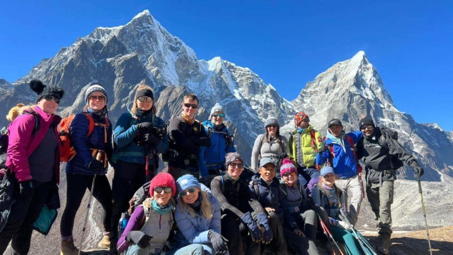
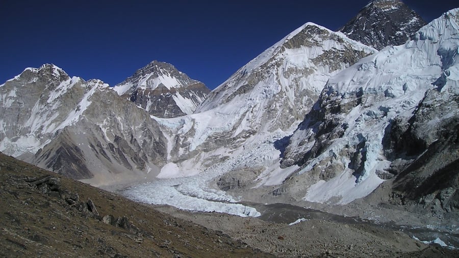
Tilicho Lake, Thorong La Pass, Poon Hill sunrise, Muktinath temple complex

Where this trip takes you

Tilicho Lake, Thorong La Pass, Poon Hill sunrise, Muktinath temple complex

The route

Where you'll travel

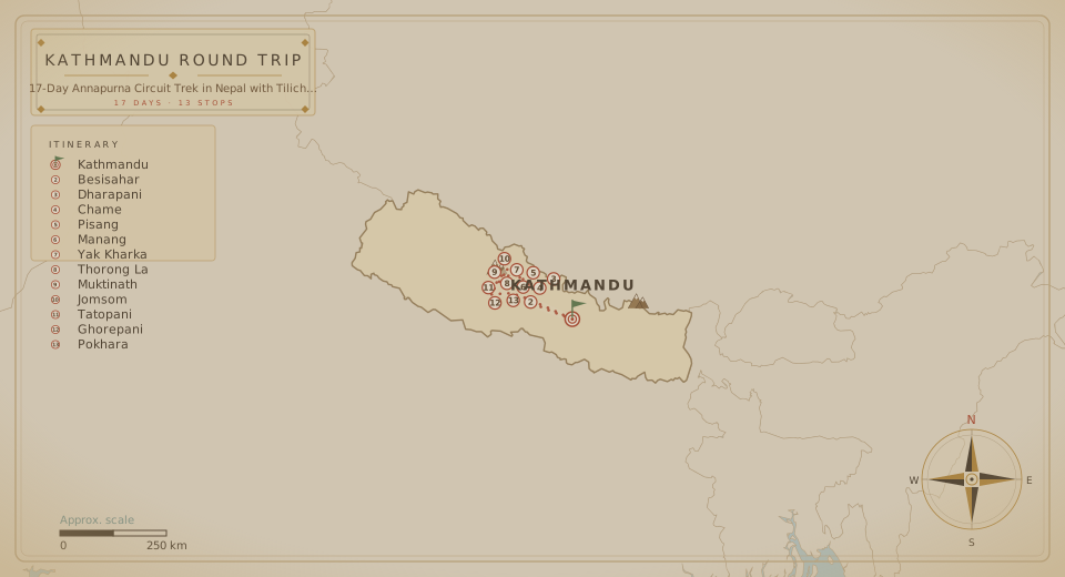
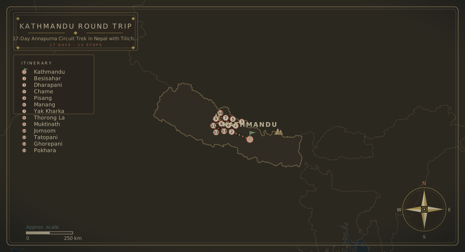
Tour route map
Round trip from Kathmandu 44600 14 cities · 17 Days

The fine print

Trip details

What's Included

  • TIMS (Trekkers' Information Management System) permit and Annapurna Conservation Area Permit (ACAP): These permits are required for trekking in the Annapurna region and are included in the cost.
  • Transportation: Transportation from Kathmandu to the starting point of the trek (usually Besisahar) and the return journey from Nayapul to Pokhara is included.
  • Accommodation during the trek: The cost includes accommodation in teahouses or lodges along the trekking route. These basic accommodations provide a bed and shared facilities such as bathrooms. The number of nights included will depend on the duration of the trek.
  • Meals: Breakfast, lunch, and dinner are provided during the trek. The meals are basic but nutritious, typically consisting of local Nepali or international dishes.
  • Guide and Porter: The cost includes the services of an experienced trekking guide who will accompany you throughout the trek. A porter is also provided to carry your main luggage, allowing you to trek with a lighter backpack.
  • Salary, Insurance, and Expenses of Guide and Porter: The cost covers the salary, insurance, and other expenses of the guide and porter, ensuring their well-being during the trek.

What's Not Included

  • International and domestic flights: The cost does not include airfare to and from Nepal or any domestic flights within Nepal.
  • Visa fees: The cost of obtaining a visa for Nepal is not included in the package. This can be obtained upon arrival at Tribhuvan International Airport in Kathmandu or through the Nepalese embassy or consulate in your home country.
  • Personal trekking equipment: You are responsible for bringing your own trekking gear, such as a sleeping bag, trekking poles, waterproof clothing, and appropriate footwear.
  • Meals in Kathmandu and Pokhara: The cost excludes meals in Kathmandu and Pokhara, allowing you the flexibility to choose from a wide range of restaurants and eateries.
  • Personal expenses: Any additional expenses such as snacks, beverages, Wi-Fi, hot showers, charging electronic devices, and personal purchases are not included in the package.
  • Travel insurance: It is highly recommended to have travel insurance that covers medical expenses, emergency evacuation, and trip cancellation/interruption.

What to bring

When preparing for the Annapurna Circuit Trek with a side trip to Tilicho Lake, it is crucial to pack the right gear and supplies to ensure a safe and enjoyable trekking experience. Here is a comprehensive list of items you should consider bringing:

Clothing:

  • Moisture-wicking base layers (tops and bottoms)
  • Insulating layers (fleece jacket, down jacket)
  • Trekking pants (convertible pants are practical)
  • Waterproof and windproof jacket
  • Waterproof and breathable pants
  • Long-sleeved shirts (for sun protection)
  • T-shirts
  • Underwear and socks (wool or synthetic)
  • Warm hat and gloves
  • Sun hat or cap
  • Bandana or buff

Footwear:

  • Sturdy trekking boots (broken-in and waterproof)
  • Hiking socks (wool or synthetic)
  • Camp shoes or sandals (for resting in tea houses)

Gear and Equipment:

  • Backpack (50-70 litres capacity)
  • Daypack (smaller size for day hikes)
  • Sleeping bag (rated for cold temperatures)
  • Sleeping pad or mattress
  • Trekking poles (helpful for stability and reducing strain)
  • Headlamp (with spare batteries)
  • Sunglasses (with UV protection)
  • Water bottles or hydration system
  • Duct tape (multi-purpose)
  • Plastic bags (for waterproofing and organizing)
  • Quick-dry towel

Personal Hygiene and Medical Supplies:

  • Toiletries (toothbrush, toothpaste, biodegradable soap, etc.)
  • Hand sanitizer
  • Wet wipes
  • Sunscreen (with high SPF)
  • Lip balm with SPF
  • Insect repellent
  • Personal medications (if any)
  • First aid kit (including basic supplies and any necessary prescription medications)

Miscellaneous:

  • Trekking map or guidebook
  • Trekking permits (Annapurna Conservation Area Permit, TIMS card, and restricted area permits, if required)
  • Cash (small Nepali currency denominations)
  • Snacks (energy bars, nuts, chocolate, etc.)
  • Camera and extra batteries
  • Power bank or portable charger
  • Travel adapter (if needed)

It is important to pack light and prioritize essential items. Remember to check the weather conditions and consult with experienced trekkers, guidebooks, or a local trekking agency for any specific recommendations or updates on gear requirements. Additionally, consider hiring a licensed guide and porter to enhance your safety and comfort throughout the trek.

Know before you go

  • Before embarking on the Annapurna Circuit Trek with a side trip to Tilicho Lake, there are several important things you should know and consider:
    • Trekking Permits: The Annapurna Circuit Trek requires obtaining two permits: the Annapurna Conservation Area Permit (ACAP) and the Trekkers' Information Management System (TIMS) card. These permits can be obtained through registered trekking agencies in Nepal or the Nepal Tourism Board office in Kathmandu or Pokhara.
    • Trekking Season: The best time to trek the Annapurna Circuit with Tilicho Lake is during the spring (March to May) and autumn (September to November) seasons. These months offer stable weather, clear skies, and favorable trekking conditions. The monsoon season (June to August) brings heavy rainfall and may cause landslides, while winter (December to February) brings cold temperatures and snowfall at higher elevations.
    • Physical Fitness and Acclimatization: The Annapurna Circuit Trek with Tilicho Lake is a challenging trek that reaches high altitudes. Prior physical fitness and some hiking experience are recommended. Acclimatization is crucial to avoid altitude sickness, so plan for rest days along the trek to allow your body to adjust to higher altitudes.
    • Trekking Guide and Porter: While hiring a guide and porter is not mandatory for the Annapurna Circuit Trek, it is highly recommended, especially if you have limited trekking experience. A guide can assist with navigation, provide insights about the region, and ensure your safety. A porter can carry your heavy backpack, allowing you to trek more comfortably.
    • Accommodation and Food: The Annapurna Circuit route has numerous teahouses along the trail that offer basic accommodation and meals. However, facilities can vary in terms of comfort and cleanliness, especially in remote areas. The teahouses typically serve a variety of local and international dishes, including dal bhat (a traditional Nepali meal), soups, noodles, and rice dishes. It is advisable to carry some snacks and energy bars with you.
    • Altitude Considerations: The Annapurna Circuit Trek with Tilicho Lake involves reaching high altitudes, including the challenging Thorong La Pass at 5,416 meters (17,769 feet). It is essential to understand the symptoms of altitude sickness and take proper precautions. Ascend gradually, stay hydrated, and listen to your body. If you experience severe symptoms, descend immediately and seek medical assistance.
    • Weather and Trail Conditions: The weather in the Annapurna region can be unpredictable, and temperatures can vary significantly. It is crucial to check weather forecasts and be prepared for changes in conditions. The trail conditions range from well-marked paths to rugged and rocky sections. Some parts may require crossing suspension bridges and steep ascents and descents. Good-quality trekking gear and sturdy footwear are essential.
    • Communication and Connectivity: While trekking in the Annapurna region, expect limited or no mobile network coverage in remote areas. Some teahouses may have Wi-Fi, but it may be slow and unreliable. Inform your loved ones about your trekking itinerary beforehand.
    • Safety and Emergency: Safety should be a priority during the trek. Always follow your guide's instructions, be cautious on steep sections, and avoid trekking alone. Carry a comprehensive first aid kit, travel insurance that covers high-altitude trekking, and have an emergency evacuation plan in place.
    • Responsible Trekking: Practice responsible and sustainable trekking. Respect the environment by disposing of waste properly, using designated trails, and avoiding single-use plastics. Support local businesses and communities by purchasing local products and services.
  • It is recommended to consult with experienced trekkers, trekking agencies, or guidebooks for the most up-to-date information and to prepare for the Annapurna Circuit Trek with Tilicho Lake adequately.

Logistics

Meeting & route

Meeting point
Kathmandu, Nepal
Tour start
Kathmandu 44600, Nepal
Tour ends at the same location as the start point.
End of the journey

Your 17 days finish where they began, in Kathmandu 44600.

Watch the tourHQ film Watch the film

Create your own adventure

Can't find the perfect tour? Tailor your dream trip.

  • Tell us your destination, dates and group size.
  • Our travel experts and local guides design a tailored itinerary, just for you.
  • Enjoy your trip with peace of mind, knowing everything is taken care of.
Plan my holiday

Say goodbye to travel stress.

Starting from

USD 1,399 /person
Book This Tour

When

Travellers

Total