Tanzania · Trekking

6-Day Kilimanjaro Lemosho Route Trek to Uhuru Peak

6 Days Round trip from Shira Evacuation Rd Moderate pace

The journey

Trip highlights
  • 01 Explore Lava Tower and the "Shark's Tooth" formation on the way to Barranco
  • 02 Cross the Shira Plateau with incredible views of Kibo Peak
  • 03 Make the summit ascent between the Rebmann and Ratzel glaciers
  • 04 Reach Uhuru Peak, the highest point on Kilimanjaro and the African continent
  • 05 Receive your personal summit certificate at Mweka Gate

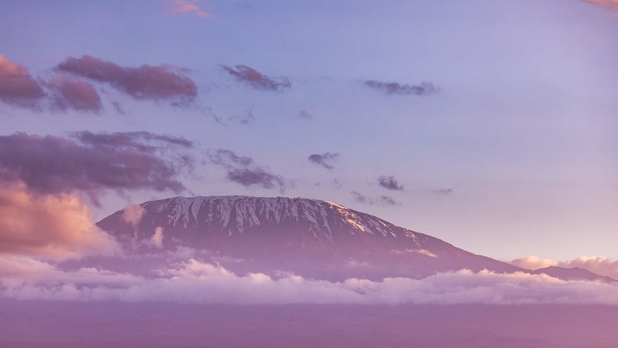
Embark on a 6-day trek to Mount Kilimanjaro via the Lemosho Route, passing through rainforest, moorland, semi-desert, and alpine desert landscapes on your way to Uhuru Peak. Hike from Londorossi Gate across the Shira Plateau, past volcanic formations such as Lava Tower and "Shark's Tooth," and follow the South Circuit with sweeping summit views. This route also supports acclimatization before the final midnight ascent between the Rebmann and Ratzel glaciers. Complete your adventure with a descent through Mweka and receive your summit certificate for Kilimanjaro.

At Uhuru Peak, you will have reached the highest point of Kilimanjaro and the African continent.

From the itinerary

At a glance

What this trip includes

Duration 6 Days
Tour type Private
Activity level Moderate
Accommodation Not included
Transport Included
Wheelchair access No
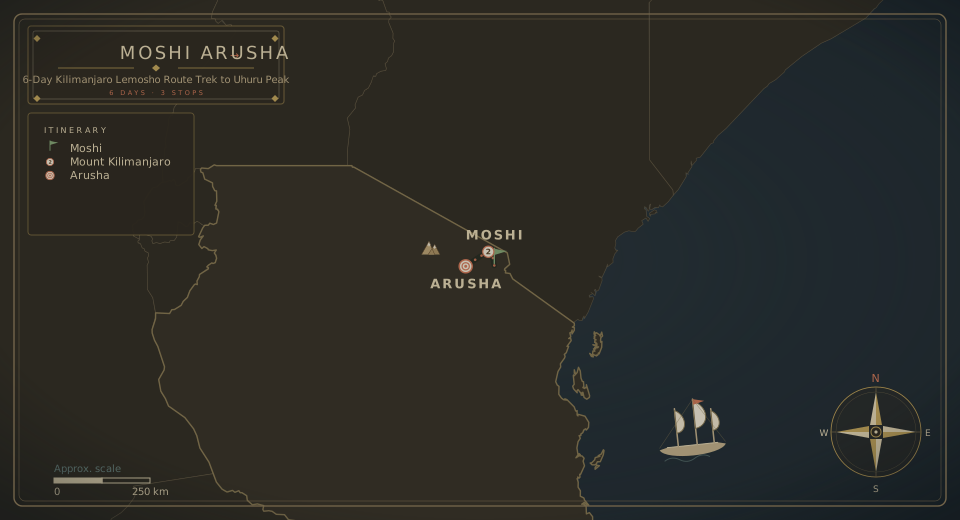
Cities Arusha, Moshi, Mount Kilimanjaro
Languages English

Day by day

The itinerary

1
Day 01

Londorossi Gate to Forest Camp Through Rainforest

  • Elevation (ft): 7,800ft to 9,500ft, Distance: 6 km, Hiking Time: 4 hours, Habitat: Rain Forest

We leave Moshi for Londorossi Gate, a drive of about 4 hours, where you will complete immigration formalities. We then continue by vehicle to the Lemosho trailhead, which takes about another hour. Upon arrival at the trailhead, we will have lunch before starting the trek through the winding jungle to the first campsite.

2
Day 02

Forest Camp to Shira I and Shira II Across Moorland

  • Elevation (ft): 9,500ft to 12,500ft, Distance: 18 km, Hiking Time: 10 hours, Habitat: Moorland

We continue on the path as it leaves the forest and enters a savannah of tall grasses, heather, and volcanic rocks draped with lichen beards. Ascending through lush hills and crossing several streams, we reach Shira Ridge before descending gently to Shira I Camp.

The views of Kibo Peak from the other side of the Shira Plateau are incredible. From here, it is a gentle trek east across the Shira Plateau toward Kibo Glacier Peak, continuing through moorland meadows along a creek to Shira II Camp.

3
Day 03

Shira II to Lava Tower and Barranco Camp

  • Elevation (ft): 12,500ft to 13,000ft, Distance: 10 km, Hiking Time: 8 hours, Habitat: Semi Desert

From the Shira Plateau, continue east along a ridge past the junction to Kibo Peak. As we go on, our direction changes to the southeast toward the lava tower called "Shark's Tooth." Shortly after the tower, we reach the second crossroads, which leads to the Pfeilgletscher.

We then continue to Barranco Refuge, where we rest, enjoy dinner, and spend the night. Although you end the day at nearly the same altitude as where you started, this day is significant for acclimatization and helps your body prepare for summit day at Uhuru Peak.

4
Day 04

Barranco Wall, Karanga Valley and Barafu Camp

  • Elevation (ft): 13,000ft to 15,000ft, Distance: 11 km, Hiking Time: 9 hours, Habitat: Alpine Desert

After breakfast, we leave Barranco and continue up a steep ridge past the Barranco Wall to the Karanga Valley campsite. We then leave Karanga and reach the turnoff that leads to the Mweka Trail before continuing to Barafu Hut.

At this point, you have completed the South Circuit, which offers views of the summit from many angles. Here we camp, rest, have dinner, and prepare for summit day. The two peaks, Mawenzi and Kibo, can be seen from this position.

5
Day 05

Midnight Summit Push to Uhuru Peak and Descent to Mweka

  • Elevation (ft): 15,300ft to 19,345ft (and down to 10,000ft), Distance: 6 km ascent / 13 km descent, Hiking Time: 8 hours ascent / 7 hours descent, Habitat: Arctic

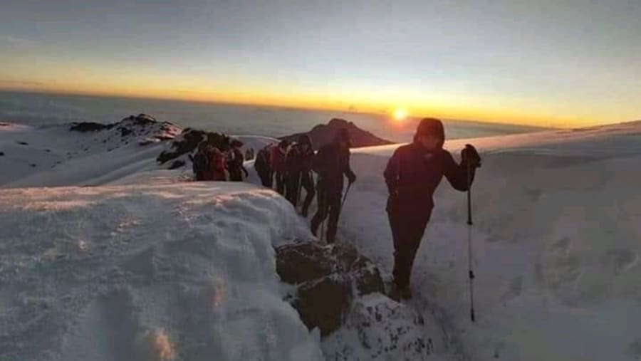
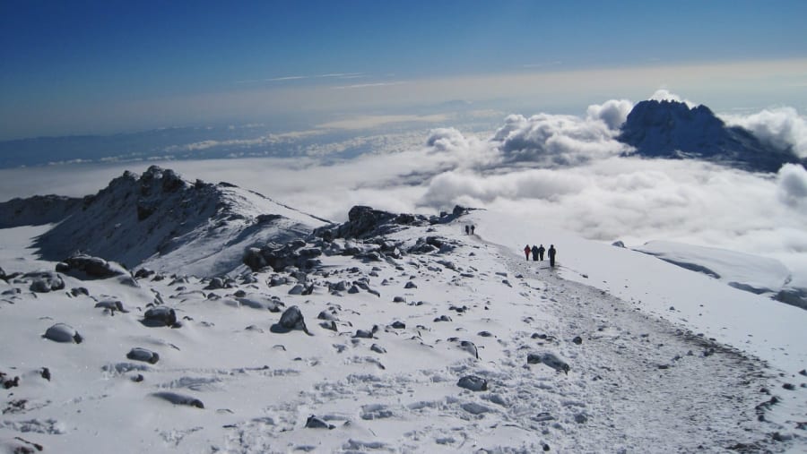
Early in the morning, around midnight, we continue to the summit between the Rebmann and Ratzel glaciers. You head northwest and climb through dense boulders toward Stella Point on the crater rim. This is the most mentally and physically challenging part of the trek.

At Stella Point, you will take a short break and be rewarded with the most magnificent sunrise you have ever seen. Snow can often be found at Stella Point during your final 1-hour climb to the summit of Mt Uhuru. At Uhuru Peak, you will have reached the highest point of Kilimanjaro and the African continent. If all goes well, you can see the sunrise from the summit.

From the summit, we descend directly to Mweka Hut Camp, stopping at Barafu Camp for lunch. You will need gaiters and hiking poles for the loose gravel on the descent. Mweka Camp is situated in the upper part of the forest, and fog or rain can be expected in the late afternoon. Later in the evening, we enjoy our last dinner on the mountain.

6
Day 06

Descend to Mweka Gate and Return to Moshi or Arusha

  • Elevation (ft): 10,000ft to 5,400ft, Distance: 10 km, Hiking Time: 3-4 hours, Habitat: Rain Forest

After breakfast, we continue the descent to Mweka Gate, where you will receive your summit certificates for Kilimanjaro. It can be wet and muddy at the lower elevations. From Mweka Gate, a vehicle will take you back to your hotel in Moshi or Arusha.

Shira Plateau, Lava Tower, "Shark's Tooth", Uhuru Peak

Where this trip takes you

Shira Plateau, Lava Tower, "Shark's Tooth", Uhuru Peak

The route

Where you'll travel

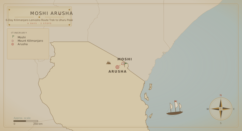
Tour route map
Round trip from Shira Evacuation Rd 3 cities · 6 Days

The fine print

Trip details

What's Included

  • Transportation to and from your selected route
  • Transfer from the airport or bus station in Moshi/Arusha on arrival, and return to the airport or bus station after the climb
  • Certified, experienced, English-speaking mountain guides
  • Kilimanjaro National Park fees
  • Government climbing taxes
  • Climbing permits
  • All hot meals prepared by our cook while on the mountain
  • Guides', porters', and cook salaries
  • Enough porters to carry your luggage
  • Safety equipment
  • Emergency oxygen
  • Hot drinks at every meal
  • Water provided on the climb: mineral water for the first day and boiled water every day
  • Personal summit certificate signed by the National Park and your guide

What's Not Included

  • Personal items
  • All items of a personal nature, such as telephone calls, fax, emails, etc.
  • Alcoholic drinks
  • Laundry services
  • Tips for guides, porters, and cook
  • Visa

What to bring

  • Price for rent per trip
  • Head torch - $10
  • Warm hat - $10
  • Sunglasses - $10
  • Scarf or balaclava - $5
  • Sun hat - $7
  • T-shirt - $5
  • Thermals top and bottom, 3 pairs - $8 per item
  • Fleece - $10
  • Down jacket - $15
  • Water/windproof jacket - $10
  • Poncho - $10
  • Waterproof trousers - $5
  • Gloves liner - $5
  • Hiking trousers - $10
  • Waterproof trousers - $10
  • Hiking socks, 1 pair - $5
  • Hiking boots - $15
  • Water bottle - $5
  • Camel back water bag - $10
  • Day pack - $20
  • Rack sack - $5
  • Rack sack cover - $5
  • Sleeping bag - $15
  • Sleeping bag liner - $10
  • Hiking poles - $10
  • Gaiters - $10

Logistics

Meeting & route

Meeting point
Moshi, Tanzania
Tour start
Shira Evacuation Rd, Tanzania
Tour ends at the same location as the start point.
End of the journey

Your 6 days finish where they began, in Shira Evacuation Rd.

Watch the tourHQ film Watch the film

Create your own adventure

Can't find the perfect tour? Tailor your dream trip.

  • Tell us your destination, dates and group size.
  • Our travel experts and local guides design a tailored itinerary, just for you.
  • Enjoy your trip with peace of mind, knowing everything is taken care of.
Plan my holiday

Say goodbye to travel stress.

Starting from

USD 1,400 /person
Book This Tour

When

Travellers

Total