
Tierra del Fuego National Park Hiking Excursion
Tour Itinerary
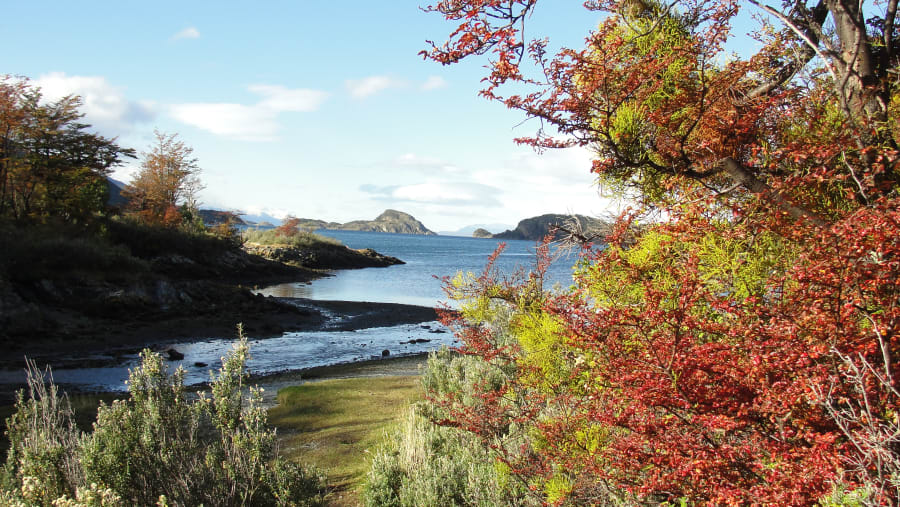
First hike - "COAST TRAIL"
Medium difficulty - Duration: 40 minutes
We start the first hike at Ensenada Bay, taking part of the shore trail while enjoying the awesome views of the Beagle Channel and its wildlife. At this point, it is possible to see the flag trees, bent by the strong Pacific Ocean winds. From there, it is possible to observe the Murray Channel, which was crossed by Charles Darwin and Captain Fitz Roy in 1830 when they discovered the Beagle Channel and interacted with the natives. It is also possible to get up close to 8,000-year-old archaeological sites where the natives used to build their shelters.
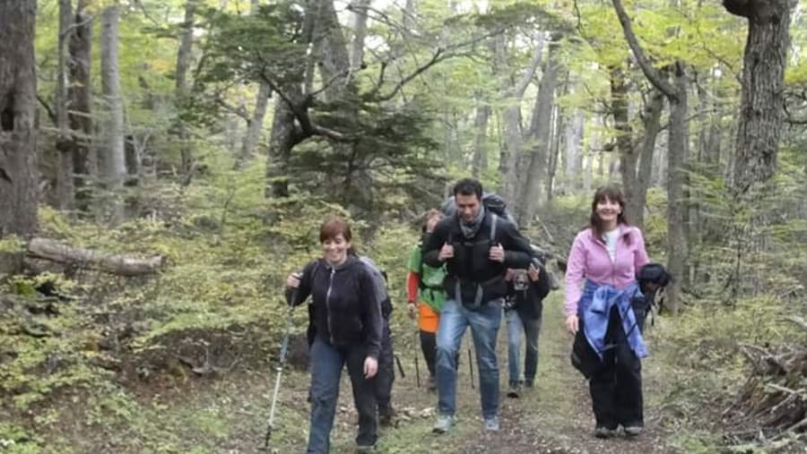
Second hike - "CAÑADON DEL TORO"
Low difficulty - Duration: 30 minutes
After hiking through the peaceful Andean forest with an amazing mountain landscape, we will get to a viewpoint to appreciate one of the cascades of Rio Pipo, meltwater that comes from the glaciers and empties into the Beagle Channel.
Third hike - "ROCA LAKE AND LAPATAIA RIVER"
Low difficulty - Duration: 20 minutes
We head towards Roca Lake, where guests can take a peaceful and charming walk around part of the lake and part of Lapataia River, taking magnificent photos. After a short stroll, we will arrive at a coffee shop where you will be able to purchase hot chocolate and/or snacks while enjoying the panoramic view of the mountains, forest, and rivers. I suggest you bring at least $20 USD for a snack at this stop.
After our stop, we will cross the Lapataia River, visiting the Cormoranes Archipelago, the Green Lagoon, and the Ovando River.
Fourth hike - "LAPATAIA VIEW POINT"
Medium difficulty - Duration: 40 minutes
We will walk beyond the actual End of the World, the end of the Panamerican Highway, surrounding Lapataia Bay, where we will have amazing views of the Darwin Range, which has the highest mountains on the island, with year-round snow caps on the peaks.
Next, you will experience a wonderful hike across the forest where we will observe impressive beaver dams. If we are lucky, we may even spot a beaver or two.
Afterwards, we will arrive at the end of the trail, from where you will breathe the freshest and purest air in the world while delighting in scenic views of the mountains, the forests, the snow, and the sea.
Finally, we will drive to Lapataia Bay, the end of the Panamerican Highway, where we will see the famous Alaskan mileage-marker sign before returning to the ship.