Kathmandu to Soti Khola by Bus
Meet your trekking staff for pick-up from your hotel.
Take a 9-hour bus journey to Soti Khola. The first 4 hours will be a comfortable drive, and the last 5 hours will be on a dirt road.
Nepal · Trekking
The journey
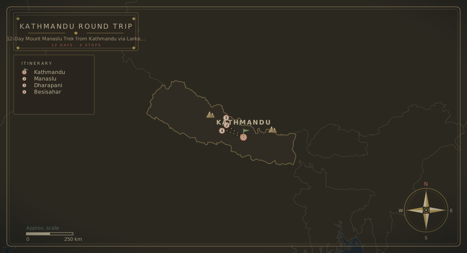
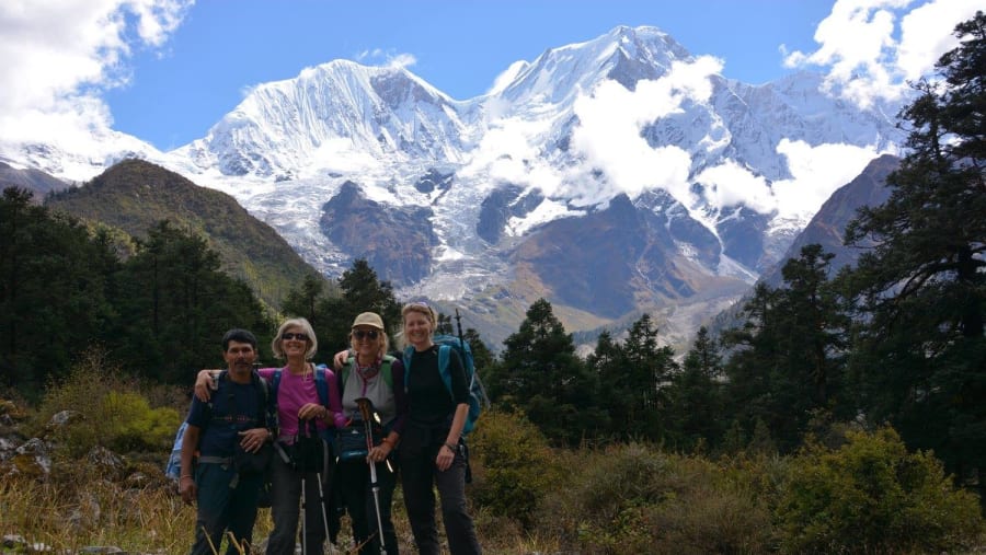
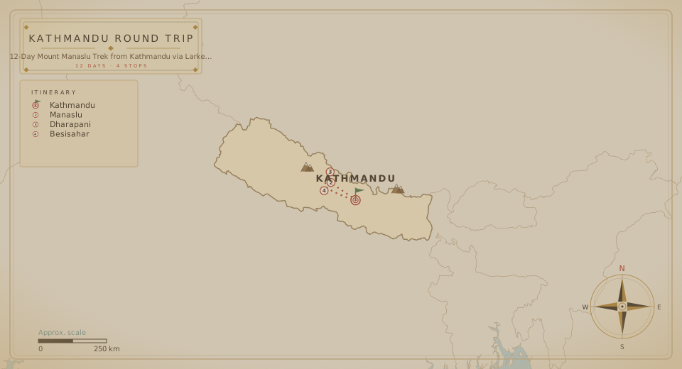
Take this adventurous and challenging trek to the base of Mount Manaslu in the Nepal Himalayas. Travel through beautiful landscapes of forests, villages, rivers, and glaciers as you follow the Manaslu trail from Kathmandu to Dharapani. Along the way, experience Tibetan culture, soak in Tatopani Hot Spring, and enjoy magnificent Himalayan panoramas, including views from Larke Pass.
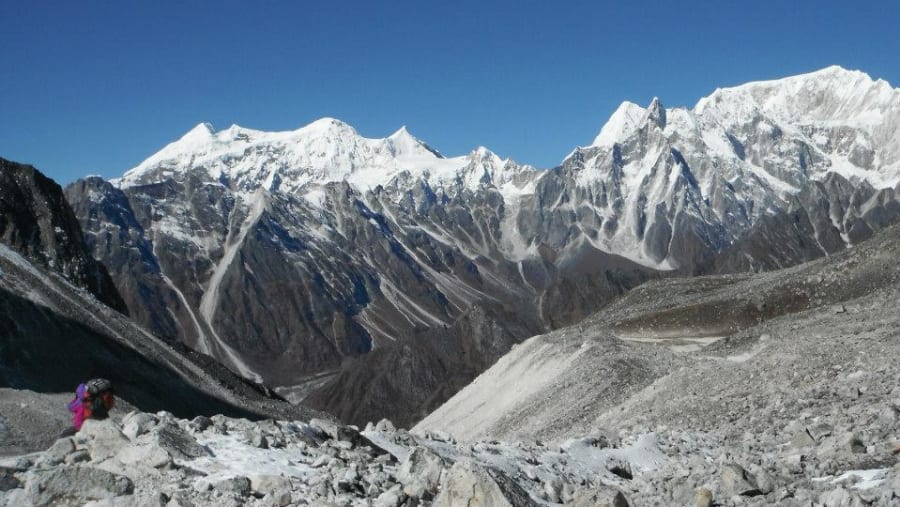
Witness the magnificent panorama from the top, with views of Himlung Himal (7,126 m), Cheo Himal (6,820 m), Gyagi Kung, Kang Kuru (6,981 m), and Annapurna II (7,937 m).
From the itinerary
At a glance
Day by day
Meet your trekking staff for pick-up from your hotel.
Take a 9-hour bus journey to Soti Khola. The first 4 hours will be a comfortable drive, and the last 5 hours will be on a dirt road.
Begin your trek into the valley, which bifurcates and reaches the other side of the Budhi Gandaki River.
Reach Lampu Besi, from where the trail follows down to the sandy riverbed of the Budhi Gandaki.
Cross Maccha Khola and walk along the river for one and a half hours to reach Khola Bensi for an overnight stay.
Leave Khola Bensi after breakfast and walk for an hour to reach Tatopani Hot Spring.
Take the trail through the forested area toward Dovan. There is a huge rapid on the Budhi Gandaki below Dovan. As the elevation increases, the rapids and the scenery undergo a complete transformation.
Reach Jagat, where your trekking permits will be checked at the police check-post.
Ascend with your Nepal trekking guide to the terraced hill of Salleri, from where you can view Sringi Himal, a sub-range of the Nepalese Himalayas.
Continue toward Sirdibash village, where the Gandaki Valley narrows down.
Cross the Budhi Gandaki River and reach Phillim, which lies on the right bank.
Walk through sub-tropical and moderate areas toward Deng, where you will stay for the night.
Follow the trail upstream along the Deng River and reach a tiny village of four houses.
Walk through the newly built rock tunnel from here, avoiding the traditional steep climb, until you reach Ghap.
Witness the Tibetan culture at Ghap, where many Mani stones and Chhortens can be seen all around.
Cross the wooden bridge over the Budhi Gandaki.
Follow the path lined with houses interspersed with cultivated fields.
Reach Namrung, where you will stay overnight.
Get your permits checked at the police check-post in Namrung.
Cross the Hinan River, which originates from the Linda Glacier, and continue to Sho. Numerous peaks are visible from here, including Naike Peak, Manaslu North (7,774 m), and Manaslu (8,150 m).
Stop at a small village for lunch before heading to Samagaun.
Pass the stone gate and the long Mani stone wall of the village after Lho. From here, you can get a full view of Peak 29.
Make a side excursion to Pungen Glacier to get a close-up view of Manaslu.
Follow the lateral moraine of Pungen Glacier toward Sama.
Take a 20-minute trail to reach Samagaun for an overnight stay.
Spend a day in Samagaun in order to acclimatize and adjust to the thinning air at high altitude.
Alternatively, you can take a local excursion around Samagaun and Sama Gompa.
Walk to Birendra Tal, a freshwater lake located in the Manaslu Glacier, and continue higher up to Manaslu Base Camp if you want a little adventure on this day.
Climb a terraced hill on the opposite bank of the Budhi Gandaki River.
Reach Samdo, the most remote permanent settlement. Here, 200 villagers live in 40 houses amidst severe weather conditions.
Climb a little higher to explore the Himalayan wildlife.
Commence your trek to Larke Bazaar and Larke Phedi (Dharmshala) after breakfast.
Have lunch and continue ahead to explore the higher Himalayan arena.
Climb toward Cho Chanda and slowly head uphill toward the snow-covered pass.
Witness the magnificent panorama from the top, with views of Himlung Himal (7,126 m), Cheo Himal (6,820 m), Gyagi Kung, Kang Kuru (6,981 m), and Annapurna II (7,937 m).
Take a steep descent through moraines toward Bhimtang.
Climb gently through paddy fields toward the small Karcha La Pass.
Descend through fig tree and rhododendron forests to Tilje village, then walk down to Dharapani.
Overnight stay at Dharapani.
Take a vehicle downstream, passing the village.
Take the trail to the bank of the Marshyangdi River and pass through the towns of Bhulbhule and Khudi until you reach Besisahar.
Embark on a bus journey to Kathmandu.
Where this trip takes you
Larke Pass, Tatopani Hot Spring, Samagaun, Pungen Glacier
The route
The fine print
Surface transportation
Accommodation
English-speaking Nepali tour guide
National Park fees
TIMS card/local tax
Wages, equipment, insurance, and other facilities for staff
Hotel accommodation in Kathmandu
Personal expenses
Travel insurance
Medical evacuation in case of emergency
Down jacket
Tips
Footwear required: good-quality, tough walking shoes, thick socks, and camp shoes.
Clothing required: down/fibre-filled waterproof jacket and trousers, sweater or fleece jacket, underwear, warm and cotton trousers or jeans, shirts, T-shirts, shorts, thermals, woollen caps, sun hat, gloves, bathing suit, and a tracksuit.
Other equipment: sleeping bag (4 seasons), trekking hold-all or stash sack with lock, daypack, water bottle, sun block cream, sunglasses, flashlight with spare bulbs and batteries, and lip balm.
Other items: insect repellent, toilet articles, diary, toilet roll, laundry soap, pocket knife, tie cord, towel, sewing kit, plasters, binoculars, camera, film, cards, and personal medical kit.
Logistics
Your 12 days finish where they began, in Kathmandu 44600.
Watch the film
Create your own adventure
Say goodbye to travel stress.
Starting from
When
Travellers
Total
—