Arrival in Islamabad
Activity: Arrival at Islamabad International Airport. Meet and greet by the North Pakistan Adventure team and transfer to your hotel.
Overnight: Islamabad Hotel
Elevation: ~540 m
Meals: Dinner
The journey
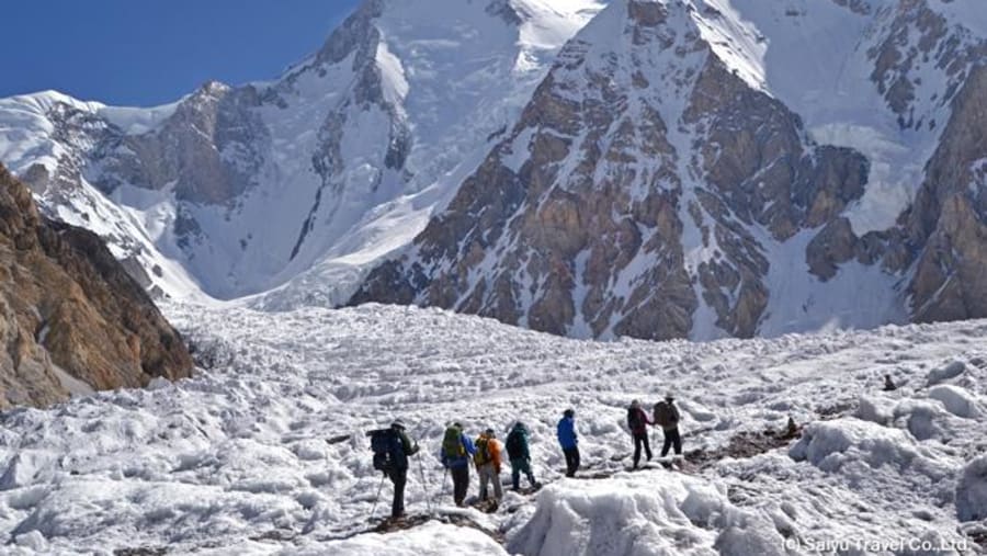
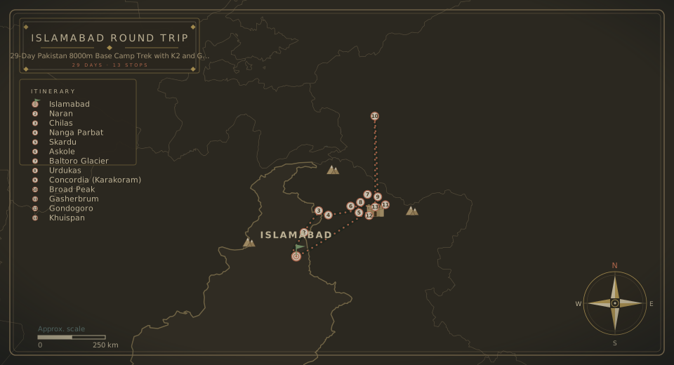
Pakistan is home to five of the world's fourteen 8,000-meter peaks: K2, Nanga Parbat, Gasherbrum I, Broad Peak, and Gasherbrum II. This extraordinary journey combines the Karakoram and western Himalaya, linking Nanga Parbat Base Camp with the Baltoro-Concordia region, where K2, Broad Peak, Gasherbrum I, and Gasherbrum II rise around one of the world's greatest high-mountain panoramas. It is a demanding, expedition-level trek across rocky trails, glacial moraine, and extensive glacier terrain, with camping, cooks, porters, and full expedition support throughout. The route reaches approximately 5,700 m at Gondogoro La, with K2 Base Camp at around 5,150 m.

At a glance
Day by day
Activity: Arrival at Islamabad International Airport. Meet and greet by the North Pakistan Adventure team and transfer to your hotel.
Overnight: Islamabad Hotel
Elevation: ~540 m
Meals: Dinner
Activity: Arrival at Islamabad International Airport. Meet and greet by the North Pakistan Adventure team and transfer to your hotel.
Overnight: Islamabad Hotel
Elevation: ~540 m
Meals: Dinner
Activity: Drive from Islamabad to Chilas, a 9-10 hour journey via Naran and Babusar Pass. Alternatively, drive from Skardu toward Chilas along the Indus Valley.
Driving Time: Approximately 8-10 hours
Overnight: Chilas Hotel
Elevation: ~1,200 m
Activity: From Chilas, drive to Raikot Bridge (1-2 hours) and transfer to local 4x4 jeeps to Tatto Village. From Tatto, trek through alpine forest to Fairy Meadows.
Jeep Journey: Approximately 1 hour
Trek: Approximately 2-3 hours
Overnight: Fairy Meadows in huts
Elevation: Fairy Meadows ~3,300 m
Activity: Trek through the pine forest toward Beyal Camp as the north face of Nanga Parbat becomes increasingly spectacular.
Distance: Approximately 5-7 km one way
Walking Time: 3-5 hours
Overnight: Beyal Camp in huts
Elevation: Beyal ~3,500 m
Activity: Continue beyond Beyal toward the Raikot-side Nanga Parbat Base Camp (8,126 m) and return to Fairy Meadows.
Distance: Approximately 10-14 km return, depending on the established route
Walking Time: 6-7 hours
Overnight: Fairy Meadows in huts
Maximum Elevation: Approximately 3,900-4,000 m
Activity: Descend from Fairy Meadows to Tatto, drive by jeep to Raikot Bridge, and continue to Skardu.
Trek: 2-3 hours
Drive: Approximately 5-6 hours
Overnight: Skardu Hotel
Elevation: ~2,200-2,500 m
Meals: Breakfast, lunch & dinner
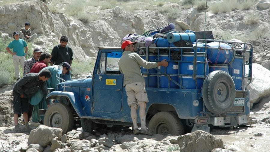
Activity: After final preparations, drive by 4WD vehicles through Shigar and the Braldu Valley toward Askoli, the last major village before the Baltoro wilderness.
Driving Time: Approximately 6-8 hours
Overnight: Askoli Camp
Elevation: ~3,000 m
Activity: Our first trekking day begins along the Braldu River, passing the Biafo Glacier area before continuing toward Jhola.
Distance: Approximately 18-20 km
Walking Time: 6-8 hours
Overnight: Jhola Camp
Elevation: ~3,100 m
Meals: Breakfast, lunch & dinner
Activity: Trek upstream along the Braldu River toward Paiju as the landscape gradually changes with the approach of the great Baltoro Glacier.
Distance: Approximately 19-20 km
Walking Time: 6-8 hours
Overnight: Paiju Camp
Elevation: ~3,400-3,500 m
Activity: Rest and acclimatization day with optional short walks around Paiju in preparation for the higher Baltoro Glacier.
Overnight: Paiju Camp
Elevation: ~3,400 m
Activity: Enter the spectacular Baltoro Glacier region, passing through the famous Trango Tower and Uli Biaho landscape.
Distance: Approximately 14-15 km
Walking Time: 5-7 hours
Overnight: Khoburtse Camp
Elevation: ~3,800 m
Activity: A shorter but spectacular glacier day crossing glacial terrain and climbing toward the famous Urdukas campsite.
Distance: Approximately 6-7 km
Walking Time: 4-6 hours
Overnight: Urdukas Camp
Elevation: ~4,050 m
Activity: Continue across the Baltoro Glacier with magnificent views of Masherbrum, Muztagh Tower, Cathedral Peaks, and surrounding Karakoram giants.
Distance: Approximately 11-12 km
Walking Time: 6-8 hours
Overnight: Goro II Camp
Elevation: ~4,250-4,300 m
Activity: One of the most spectacular days of the expedition, following the upper Baltoro Glacier toward Concordia, surrounded by the greatest peaks of the Karakoram.
Distance: Approximately 11-12 km
Walking Time: 5-7 hours
Overnight: Concordia Camp
Elevation: ~4,600-4,700 m
Activity: An unforgettable high-altitude excursion trekking toward the Broad Peak and Godwin-Austen Glacier region, visiting Broad Peak Base Camp (~4,800 m), Gilkey Memorial, and K2 Base Camp (~5,150 m). Depending on weather, glacier conditions, and group strength, the expedition may camp at K2 Base Camp or return to Broad Peak Base Camp.
Walking: Approximately 20-24 km combined
Walking Time: 8-10 hours
Maximum Elevation: ~5,150 m
Overnight: K2 Base Camp / K2 expedition camp
Activity: Enjoy early morning views of K2 before beginning the return journey, retracing the Godwin-Austen Glacier toward Concordia.
Distance: Approximately 12-15 km
Walking Time: 5-7 hours
Overnight: Concordia Camp
Elevation: ~4,600-4,700 m
Activity: Leave the main K2 route and continue toward the increasingly remote Gasherbrum region.
Distance: Approximately 7-10 km
Walking Time: 4-6 hours
Overnight: Shagring / Upper Baltoro Camp
Elevation: ~4,600-4,800 m
Activity: Full expedition day toward the Gasherbrum Base Camp area, visiting the base camps of Gasherbrum I (8,080 m) and Gasherbrum II (8,035 m). The exact camping point and route may change according to glacier conditions and the current expedition trail.
Walking: Approximately 12-16 km
Walking Time: 7-9 hours
Overnight: Gasherbrum Base Camp area
Elevation: Approximately 5,000 m
Activity: Return toward Concordia for an important recovery day after visiting the Gasherbrum base camps.
Walking Time: Approximately 6-8 hours
Overnight: Concordia Camp
Meals: Full board
Activity: Begin the route toward Gondogoro La as the landscape changes, approaching the Vigne Glacier and the Gondogoro Pass route. Crampons, harnesses, helmets, and glacier equipment are checked and prepared.
Distance: Approximately 10-12 km
Walking Time: 5-7 hours
Overnight: Ali Camp
Elevation: ~5,000 m
Activity: An early alpine start climbing toward Gondogoro La (~5,585 m, highest point ~5,700 m) with spectacular views of K2, Broad Peak, Gasherbrum I, Gasherbrum II, Laila Peak, Trinity Peak, and Chogolisa. The descent on the Hushe side uses fixed ropes where required. (Attempted only when conditions are considered safe by the expedition leader).
Walking Time: Approximately 8-10 hours
Highest Point: ~5,700 m
Overnight: Khuispang Camp (~4,600 m)
Activity: Rest day in Khuspang for recovery or security day to cross the pass.
Overnight: Khuispang Camp
Activity: Descend through the Gondogoro Valley toward lower elevations as the landscape changes dramatically from glacier and moraine to green alpine terrain.
Walking Time: 5-7 hours
Overnight: Saicho Camp
Elevation: ~3,350 m
Activity: Final trekking stage through the beautiful Hushe Valley, meeting vehicles in Hushe and driving toward Skardu to enjoy a hot shower, comfortable bed, and recovery dinner marking the end of the Karakoram section.
Trek: Approximately 3-5 hours
Drive: Approximately 4-6 hours
Overnight: Skardu Hotel
Meals: Full board
Activity: A full recovery day with optional activities including visiting Skardu Bazaar, Kharpocho Fort, or local villages, plus equipment drying, laundry, massage/relaxation, and essential contingency time for weather or route delays.
Overnight: Skardu Hotel
Activity: Airport drop and 1-hour flight to Islamabad, followed by transfer to the hotel for afternoon rest and meals.
Overnight: Islamabad Hotel
Activity: Rest day in Islamabad or security day for the domestic flight to Islamabad from Skardu.
Overnight: Islamabad Hotel
Meals: Hotel meals included
Activity: Departure from Islamabad with drop-off at the airport.
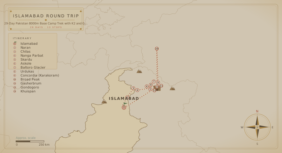
The route
The fine print
Transportation: by flight / land
Hotel accommodation
Hotel meals: breakfast, lunch, and dinner
English-speaking local guide
Entry fees: for museums, forts, and tourist resorts
Toll taxes and parking fee
International flight tickets
Personal refreshments
Medical kit and any medicine
Any extra weight for domestic flight
Grade: Demanding / expedition-level trekking
Highest trekking elevations: approximately 5,000-5,150 m
Terrain: rocky trails, glacial moraine and extensive glacier travel
Experience: Previous high-altitude trekking experience is strongly recommended.
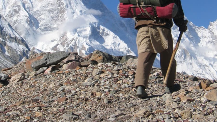
This is not a conventional lodge or tea-house trek. The Baltoro section requires camping, cooks, porters and a complete expedition support system.
(Attempted only when conditions are considered safe by the expedition leader).
Logistics
Your 29 days run from Islamabad International Airport (ISB) to Islamabad International Airport (ISB).
Watch the film
Create your own adventure
Say goodbye to travel stress.
Starting from
When
Travellers
Total
—